Baigutun Town
白古屯镇 | |
|---|---|
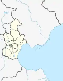
 Baigutun Town Location within Tianjin  Baigutun Town Baigutun Town (China) | |
| Coordinates: 39°32′57″N 116°54′11″E / 39.54917°N 116.90306°E | |
| Country | |
| Municipality | Tianjin |
| District | Wuqing |
| Village-level Divisions | 21 villages |
| Area | |
| • Total | 51.21 km2 (19.77 sq mi) |
| Elevation | 9 m (30 ft) |
| Population (2010) | |
| • Total | 21,443 |
| • Density | 420/km2 (1,100/sq mi) |
| Time zone | UTC+8 (CST) |
| Postal code | 301738 |
| Area code | 022 |
Baigutun Town (simplified Chinese: 白古屯镇; traditional Chinese: 白古屯鎮; pinyin: Báigǔtún Zhèn), is a town located in the northwest of Wuqing District, Tianjin, China. It shares border with Gaocun Town in its north, Hexiwu and Damengzhuang Towns in its east, Sicundian Town in its south, as well as Chengguan and Dawangguzhuang Towns in its west. The town had a population of 21,443 as of 2010.[1]
Geography
Baigutun Town is situated at the western shore of Longfeng and Fenghe Rivers, at an altitude of 9 meters above the sea level.[2]
History
| Year | Status | Under |
|---|---|---|
| 1958 – 1961 | Administered by Chengguan Hongqi People's Commune | Wuqing County, Hebei |
| 1961 – 1973 | Dongmafang People's Commune | |
| 1973 – 1983 | Wuqing County, Tianjin | |
| 1983 – 1984 | Dongmafang Township | |
| 1984 – 2000 | Baigutun Township | |
| 2000 – 2013 | Wuqing District, Tianjin | |
| 2013 – present | Baigutun Town |
Administrative divisions
By the end of 2022, Baigutun Town has the following 21 villages:[4]
- Dongmafang (东马房)
- Xihuangxinzhuang (西黄辛庄)
- Qiuguzhuang (邱古庄)
- Yanggeda (杨疙疸)
- Houtuncun (后屯村)
- Gengzhuangcun (耿庄村)
- Xuzhuang (徐庄)
- Hepingzhuang (和平庄)
- Xinfangzi (新房子)
- Daweizhuang (大魏庄)
- Xiaoweizhuang (小魏庄)
- Xiaotiancun (小天村)
- Xiaozhaozhuang (小赵庄)
- Quliuzhuang (屈刘庄)
- Baigutun (白古屯)
- Fucun (富村)
- Shaoziying (稍子营)
- Dazhaozhuang (大赵庄)
- Luotuoquan (骆驼圈)
- Tonglin (桐林)
- Hancun (韩村)
See also
References
- ↑ "China: Tiānjīn Municipal Province (Districts and Townships) - Population Statistics, Charts and Map". www.citypopulation.de. Retrieved 26 October 2023.
- ↑ "Baigutun topographic map, elevation, terrain". Topographic maps. Retrieved 26 October 2023.
- ↑ 中华人民共和国政区大典 天津卷 [Collection of Administrative Divisions of the People's Republic of China, Tianjin Volumn] (in Chinese) (Di 1 ban ed.). 2020. ISBN 978-7-5087-6215-9. OCLC 1351675957.
- ↑ "2022年统计用区划代码和城乡划分代码" [2022 Statistical Division Codes and Urban-rural Differentiation Codes]. National Bureau of Statistics of China (in Chinese). Archived from the original on 21 March 2023. Retrieved 26 October 2023.
This article is issued from Wikipedia. The text is licensed under Creative Commons - Attribution - Sharealike. Additional terms may apply for the media files.