Huangzhuang Subdistrict
黄庄街道 | |
|---|---|
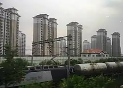
 Residential area on the northern edge of the subdistrict | |
 Huangzhuang Subdistrict  Huangzhuang Subdistrict | |
| Coordinates: 39°20′43″N 117°03′18″E / 39.34528°N 117.05500°E | |
| Country | |
| Municipality | Tianjin |
| District | Wuqing |
| Village-level Divisions | 5 communities 4 villages |
| Area | |
| • Total | 38.82 km2 (14.99 sq mi) |
| Elevation | 7 m (23 ft) |
| Population (2010) | |
| • Total | 16,881 |
| • Density | 430/km2 (1,100/sq mi) |
| Time zone | UTC+8 (CST) |
| Postal code | 301725 |
| Area code | 022 |
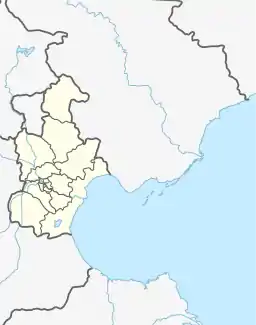
Huangzhuang Subdistrict (simplified Chinese: 黄庄街道; traditional Chinese: 黃莊街道; pinyin: Huángzhuāng Jiēdào) is a subdistrict on the south edge of Wuqing District, Tianjin, China. It borders Yunhexi and Dongpuwa Subdistricts to its north, Xiazhuzhuang and Yangcun Subdistricts to its east, Shuangjie and Shuangkou Towns to its south, as well as Zhangzhuang and Chenzui Towns to its west. In the year 2010, the subdistrict is home to 16,881 people.[1]
The name Huangzhuang (Chinese: 黄庄; lit. 'Huang's Villa') originated in the founding of the locality during Ming Dynasty, when Huang family was the first settlers in the area.[2]
Geography
Huangzhuang Subdistrict is bounded by Qianjin Avenue to the north, and the Grand Canal to the east. Both Longfeng and Yongding Rivers flow through its north. The subdistrict is connected to the Binbao Expressway in the south. Its average elevation is 7 meters above the sea level.[3]
History
| Years | Status | Belong to |
|---|---|---|
| 1957 - 1958 | Huangzhuang Township | Wuqing County, Hebei |
| 1958 - 1961 | Huangzhuang Weixing People's Commune | |
| 1961 - 1973 | Huangzhuang People's Commune | |
| 1973 - 1983 | Wuqing County, Tianjin | |
| 1983 - 2000 | Huangzhuang Township | Wuqing District, Tianjin |
| 2000 - present | Huangzhuang Subdistrict |
Administrative divisions
As of the year 2022, there are 9 subdivisions under Huangzhuang Subdistrict, of those 5 are residential communities and 4 are villages. They are:[4]
Residential community
- Quansheng Jiayuan (泉昇佳苑)
- Shuangsi Ying (双寺营)
- Binhe (滨河)
- Bintai (缤泰)
- Binyue (滨悦)
Villages
- Laomidian (老米店)
- Majiakou (马家口)
- Liuhezhuang (六合庄)
- Chengshang (城上)
See also
References
- ↑ "China: Tiānjīn Municipal Province (Districts and Townships) - Population Statistics, Charts and Map". www.citypopulation.de. Retrieved 2023-05-07.
- 1 2 Zhonghua Renmin Gongheguo zheng qu da dian. Tianjin juan (Di 1 ban ed.). 2020. ISBN 978-7-5087-6215-9. OCLC 1351675957.
- ↑ "Huangzhuang Subdistrict topographic map, elevation, terrain". Topographic maps. Retrieved 2023-05-08.
- ↑ "2022年统计用区划代码和城乡划分代码" [2022 Statistical Division Codes and Urban-rural Differentiation Codes]. www.stats.gov.cn (in Chinese). Archived from the original on 2023-03-21. Retrieved 2023-05-07.