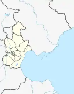
Dahuangbao Town
大黄堡镇 Dahuangpu | |
|---|---|
.jpg.webp) Chenzhuang Village in Dahuangbao | |
 Dahuangbao Town  Dahuangbao Town | |
| Coordinates: 39°26′16″N 117°16′11″E / 39.43778°N 117.26972°E | |
| Country | |
| Municipality | Tianjin |
| District | Wuqing |
| Village-level Divisions | 1 community 28 villages |
| Area | |
| • Total | 91.39 km2 (35.29 sq mi) |
| Elevation | 4 m (13 ft) |
| Population (2010) | |
| • Total | 18,432 |
| • Density | 200/km2 (520/sq mi) |
| Time zone | UTC+8 (CST) |
| Postal code | 301731 |
| Area code | 022 |
Dahuangbao Town (simplified Chinese: 大黄堡镇; traditional Chinese: 大黃堡鎮; pinyin: Dàhuángbǎo Zhèn), also known as Dahuangpu Town, is a town located in the eastern part of Wuqing District, Tianjin, China. It shares border with Cuihuangkou Town to the north, Niujiapai and Erwangzhuang Towns to the east, Shangmatai Town to the south, and Caozili Town to the west. In the year 2010, its population was 18,432.[1]
In the Ming dynasty, this region was settled by families with the surname Huang. The settlement later split into two, with the larger one becoming the town Dahuangbao (Chinese: 大黄堡; lit. 'Large Huang's Fort').[2]
Geography
Dahuangbao Town is located on the eastern shore of Longfeng River. The average elevation in the town is 4 meters.[3]
History
| Year | Status | Part of |
|---|---|---|
| 1952 – 1957 | Within 5th District | Wuqing County, Hebei |
| 1957 – 1966 | Dahuangbao Township | |
| 1966 – 1973 | Dahuangbao People's Commune | |
| 1973 – 1983 | Wuqing County, Tianjin | |
| 1983 – 2000 | Dahuangbao Township | |
| 2000 – 2013 | Wuqing District, Tianjin | |
| 2013 – present | Dahuangbao Town |
Administrative divisions
As of the year 2022, Dahuangbao Town consisted of 29 subdivisions, all of which are listed as followed:[4]
Residential community
- Chaoyangli (朝阳里)
Villages
- Dahuangbao (大黄堡)
- Xiaohuangbao (小黄堡)
- Chenzhuang (陈庄)
- Zhaozhuang (赵庄)
- Zhongxintai (忠辛台)
- Zhucaozi (朱曹子)
- Wuzhuanghu (武庄户)
- Zhangxin'anzhuang (张辛安庄)
- Qianpubang (前蒲棒)
- Houpubang (后蒲棒)
- Caojiagang (曹家岗)
- Dongbalizhuang (东八里庄)
- Simaying (四马营)
- Sigaozhuang (四高庄)
- Liujinzhuang (刘靳庄)
- Puxiantuo (普贤坨)
- Jiangzhuangzi (蒋庄子)
- Bailou (白楼)
- Wuzidian (务滋甸)
- Dayangzhuang (大杨庄)
- Xiaoyangzhuang (小杨庄)
- Xiaoshizhuang (小石庄)
- Daizhuangzi (代庄子)
- Guowangzhuang (果汪庄)
- Qianhuzhuang (千户庄)
- Dongsiwo (东丝窝)
- Xisiwo (西丝窝)
- Dongwangzhuang (东汪庄)
See also
References
- ↑ "China: Tiānjīn Municipal Province (Districts and Townships) - Population Statistics, Charts and Map". www.citypopulation.de. Retrieved 26 October 2023.
- ↑ 中华人民共和国政区大典 天津卷 [Collection of Administrative Divisions of the People's Republic of China, Tianjin Volumn] (in Chinese) (Di 1 ban ed.). 2020. ISBN 978-7-5087-6215-9. OCLC 1351675957.
- ↑ "Dahuangpu topographic map, elevation, terrain". Topographic maps. Retrieved 26 October 2023.
- ↑ "2022年统计用区划代码和城乡划分代码" [2022 Statistical Division Codes and Urban-rural Differentiation Codes]. National Bureau of Statistics of China (in Chinese). Archived from the original on 21 March 2023. Retrieved 26 October 2023.