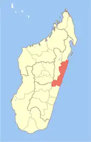
Manakana | |
|---|---|
 Manakana Location in Madagascar | |
| Coordinates: 19°49′S 48°22′E / 19.817°S 48.367°E | |
| Country | |
| Region | Atsinanana |
| District | Antanambao Manampotsy District |
| Population (2019)census | |
| • Total | 10,437 |
| • Ethnicities | Betsimisaraka |
| Time zone | UTC3 (EAT) |
| Postal code | 507 |
Manakana is a rural municipality located in the Antanambao Manampotsy District, Atsinanana region of eastern Madagascar.[1]
References
This article is issued from Wikipedia. The text is licensed under Creative Commons - Attribution - Sharealike. Additional terms may apply for the media files.
