Saint-Bomer | |
|---|---|
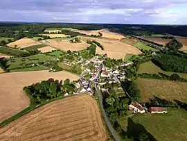 An aerial view of Saint-Bomer | |
Location of Saint-Bomer | |
 Saint-Bomer 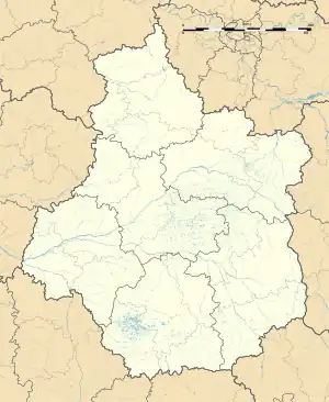 Saint-Bomer | |
| Coordinates: 48°11′46″N 0°49′43″E / 48.1961°N 0.8286°E | |
| Country | France |
| Region | Centre-Val de Loire |
| Department | Eure-et-Loir |
| Arrondissement | Nogent-le-Rotrou |
| Canton | Brou |
| Intercommunality | Perche |
| Government | |
| • Mayor (2020–2026) | Jean Albert Bassoulet[1] |
| Area 1 | 13.32 km2 (5.14 sq mi) |
| Population | 192 |
| • Density | 14/km2 (37/sq mi) |
| Time zone | UTC+01:00 (CET) |
| • Summer (DST) | UTC+02:00 (CEST) |
| INSEE/Postal code | 28327 /28330 |
| Elevation | 163–271 m (535–889 ft) (avg. 193 m or 633 ft) |
| 1 French Land Register data, which excludes lakes, ponds, glaciers > 1 km2 (0.386 sq mi or 247 acres) and river estuaries. | |
Saint-Bomer is a commune in the Eure-et-Loir department in northern France.
Population
| Year | Pop. | ±% |
|---|---|---|
| 1962 | 161 | — |
| 1968 | 202 | +25.5% |
| 1975 | 195 | −3.5% |
| 1982 | 160 | −17.9% |
| 1990 | 143 | −10.6% |
| 1999 | 178 | +24.5% |
| 2009 | 204 | +14.6% |
See also
References
- ↑ "Répertoire national des élus: les maires". data.gouv.fr, Plateforme ouverte des données publiques françaises (in French). 9 August 2021.
- ↑ "Populations légales 2021". The National Institute of Statistics and Economic Studies. 28 December 2023.
Wikimedia Commons has media related to Saint-Bomer.
This article is issued from Wikipedia. The text is licensed under Creative Commons - Attribution - Sharealike. Additional terms may apply for the media files.