Saint-Lubin-de-Cravant | |
|---|---|
 The church in Saint-Lubin-de-Cravant | |
Location of Saint-Lubin-de-Cravant | |
 Saint-Lubin-de-Cravant 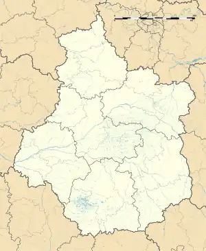 Saint-Lubin-de-Cravant | |
| Coordinates: 48°42′43″N 1°05′19″E / 48.7119°N 1.0886°E | |
| Country | France |
| Region | Centre-Val de Loire |
| Department | Eure-et-Loir |
| Arrondissement | Dreux |
| Canton | Saint-Lubin-des-Joncherets |
| Intercommunality | CA Pays de Dreux |
| Government | |
| • Mayor (2020–2026) | Pascal Baelen[1] |
| Area 1 | 6.93 km2 (2.68 sq mi) |
| Population | 56 |
| • Density | 8.1/km2 (21/sq mi) |
| Time zone | UTC+01:00 (CET) |
| • Summer (DST) | UTC+02:00 (CEST) |
| INSEE/Postal code | 28346 /28270 |
| Elevation | 140–183 m (459–600 ft) (avg. 152 m or 499 ft) |
| 1 French Land Register data, which excludes lakes, ponds, glaciers > 1 km2 (0.386 sq mi or 247 acres) and river estuaries. | |
Saint-Lubin-de-Cravant (French pronunciation: [sɛ̃ lybɛ̃ də kʁavɑ̃]) is a commune in the Eure-et-Loir department in northern France.
Population
| Year | Pop. | ±% |
|---|---|---|
| 1962 | 51 | — |
| 1968 | 57 | +11.8% |
| 1975 | 51 | −10.5% |
| 1982 | 53 | +3.9% |
| 1990 | 48 | −9.4% |
| 1999 | 60 | +25.0% |
| 2008 | 65 | +8.3% |
See also
References
- ↑ "Répertoire national des élus: les maires" (in French). data.gouv.fr, Plateforme ouverte des données publiques françaises. 4 May 2022.
- ↑ "Populations légales 2021". The National Institute of Statistics and Economic Studies. 28 December 2023.
Wikimedia Commons has media related to Saint-Lubin-de-Cravant.
This article is issued from Wikipedia. The text is licensed under Creative Commons - Attribution - Sharealike. Additional terms may apply for the media files.