Elandhanjery
எலந்தஞ்சேரி Elanthancherry | |
|---|---|
Neighbourhood | |
 Elandhanjery  Elandhanjery  Elandhanjery | |
| Coordinates: 13°11′18″N 80°16′25″E / 13.18837°N 80.27358°E / 13.18837; 80.27358 | |
| Country | |
| State | |
| District | Chennai |
| Taluk | Tiruvottiyur |
| Metro | Chennai |
| Zone & Ward | Manali Zone 2 & Ward 16 |
| Languages | |
| • Official | Tamil |
| Time zone | UTC+5:30 (IST) |
| PIN | 600103 |
| Telephone code | 044-2593 |
| Vehicle registration | TN-18-xxxx & TN-20-xxxx(old) |
| Civic agency | Greater Chennai Corporation |
| Planning agency | CMDA |
| City | Chennai |
| Lok Sabha constituency | Chennai North |
| Vidhan Sabha constituency | Tiruvottiyur |
| Website | http://www.chennaicorporation.gov.in/ |
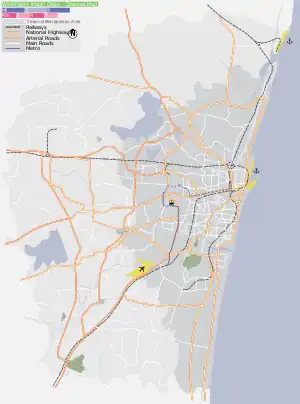
Elandhanjery (Tamil: எலந்தஞ்சேரி), is an industrial/residential area in Manali, North of Chennai, a metropolitan city in Tamil Nadu, India. In October 2011, the erstwhile Sadayankuppam village panchayat is merged with Greater Chennai Corporation and it came under the jurisdiction of Greater Chennai Corporation.[1][2] Though Elandhanjery is annexed with Greater Chennai Corporation it is remained as a part of Tiruvottiyur taluk in Tiruvallur district till 15 August 2018.
Location
Elandhanjery is located in Manali, North Chennai with Tiruvottiyur in the east and south. Other neighbouring areas include Mathur, Madhavaram, Andarkuppam, Manali Pudhunagar, Kosappur, Ennore.
Surroundings
Directions From Elandhanjery | |
|---|---|
References
- ↑ "More areas to come under Chennai Corporation". The Hindu. 30 December 2009. Retrieved 6 December 2015.
- ↑ "Expanded Chennai Corporationto be divided into 3 regions". The Hindu. 25 November 2011. Retrieved 6 December 2015.
External links
Areas of Chennai | |
|---|---|
| North |
|
| West |
|
| Central |
|
| South |
|
Neighbourhoods of Chennai (city) | |
|---|---|
|
This article is issued from Wikipedia. The text is licensed under Creative Commons - Attribution - Sharealike. Additional terms may apply for the media files.