Anvin | |
|---|---|
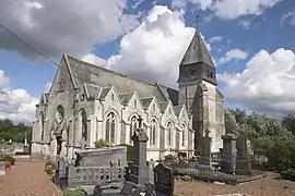 The church of Anvin | |
 Coat of arms | |
Location of Anvin | |
 Anvin  Anvin | |
| Coordinates: 50°26′50″N 2°15′22″E / 50.4472°N 2.2561°E | |
| Country | France |
| Region | Hauts-de-France |
| Department | Pas-de-Calais |
| Arrondissement | Arras |
| Canton | Saint-Pol-sur-Ternoise |
| Intercommunality | CC du Ternois |
| Government | |
| • Mayor (2020–2026) | André Olivier[1] |
| Area 1 | 7.83 km2 (3.02 sq mi) |
| Population | 726 |
| • Density | 93/km2 (240/sq mi) |
| Time zone | UTC+01:00 (CET) |
| • Summer (DST) | UTC+02:00 (CEST) |
| INSEE/Postal code | 62036 /62134 |
| Elevation | 51–150 m (167–492 ft) (avg. 60 m or 200 ft) |
| 1 French Land Register data, which excludes lakes, ponds, glaciers > 1 km2 (0.386 sq mi or 247 acres) and river estuaries. | |
Anvin (French pronunciation: [ɑ̃vɛ̃]) is a commune in the Pas-de-Calais department in northern France.[3]
Geography
Anvin is a farming village located in the Ternoise river valley, 28 miles (44 km) northwest of Arras, at the junction of the D343, D70 and D94 roads.
Population
The inhabitants are called Anvinois.
| Year | Pop. | ±% |
|---|---|---|
| 1962 | 604 | — |
| 1968 | 615 | +1.8% |
| 1975 | 587 | −4.6% |
| 1982 | 639 | +8.9% |
| 1990 | 666 | +4.2% |
| 1999 | 741 | +11.3% |
| 2005 | 833 | +12.4% |
| 2009 | 803 | −3.6% |
| 2010 | 789 | −1.7% |
| 2015 | 771 | −2.3% |
Sights
- The church of St. Leger, dating from the sixteenth century.
- The ruins of a seventeenth-century chateau.
- Vestiges of a watermill.
See also
References
- ↑ "Répertoire national des élus: les maires". data.gouv.fr, Plateforme ouverte des données publiques françaises (in French). 2 December 2020.
- ↑ "Populations légales 2021". The National Institute of Statistics and Economic Studies. 28 December 2023.
- ↑ INSEE commune file
Wikimedia Commons has media related to Anvin.
This article is issued from Wikipedia. The text is licensed under Creative Commons - Attribution - Sharealike. Additional terms may apply for the media files.