Tollent | |
|---|---|
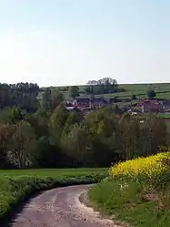 A general view of Tollent | |
 Coat of arms | |
Location of Tollent | |
 Tollent  Tollent | |
| Coordinates: 50°16′40″N 2°00′53″E / 50.2778°N 2.0147°E | |
| Country | France |
| Region | Hauts-de-France |
| Department | Pas-de-Calais |
| Arrondissement | Arras |
| Canton | Auxi-le-Château |
| Intercommunality | CC Ternois |
| Government | |
| • Mayor (2020–2026) | Regis Bezu[1] |
| Area 1 | 4.31 km2 (1.66 sq mi) |
| Population | 92 |
| • Density | 21/km2 (55/sq mi) |
| Time zone | UTC+01:00 (CET) |
| • Summer (DST) | UTC+02:00 (CEST) |
| INSEE/Postal code | 62822 /62390 |
| Elevation | 17–108 m (56–354 ft) (avg. 34 m or 112 ft) |
| 1 French Land Register data, which excludes lakes, ponds, glaciers > 1 km2 (0.386 sq mi or 247 acres) and river estuaries. | |
Tollent (French pronunciation: [tɔlɑ̃]) is a commune in the Pas-de-Calais department in the Hauts-de-France region of France.[3]
Geography
Tollent lies on the banks of the river Authie, 36 miles (58 km) west of Arras, at the junction of the D101 and D119 roads.
Population
| Year | Pop. | ±% p.a. |
|---|---|---|
| 1968 | 148 | — |
| 1975 | 118 | −3.18% |
| 1982 | 86 | −4.42% |
| 1990 | 82 | −0.59% |
| 1999 | 77 | −0.70% |
| 2007 | 88 | +1.68% |
| 2012 | 92 | +0.89% |
| 2017 | 91 | −0.22% |
| Source: INSEE[4] | ||
Places of interest
- The church of Notre-Dame, dating from the seventeenth century.
- A chapel from the eighteenth century.
See also
References
- ↑ "Répertoire national des élus: les maires". data.gouv.fr, Plateforme ouverte des données publiques françaises (in French). 9 August 2021.
- ↑ "Populations légales 2021". The National Institute of Statistics and Economic Studies. 28 December 2023.
- ↑ INSEE commune file
- ↑ Population en historique depuis 1968, INSEE
Wikimedia Commons has media related to Tollent.
This article is issued from Wikipedia. The text is licensed under Creative Commons - Attribution - Sharealike. Additional terms may apply for the media files.