Courcelles-le-Comte | |
|---|---|
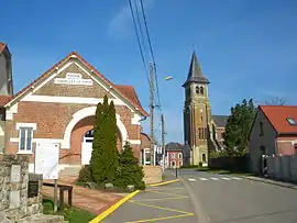 The centre of Courcelles-le-Comte | |
 Coat of arms | |
Location of Courcelles-le-Comte | |
 Courcelles-le-Comte  Courcelles-le-Comte | |
| Coordinates: 50°09′48″N 2°46′32″E / 50.1633°N 2.7756°E | |
| Country | France |
| Region | Hauts-de-France |
| Department | Pas-de-Calais |
| Arrondissement | Arras |
| Canton | Bapaume |
| Intercommunality | CC Sud-Artois |
| Government | |
| • Mayor (2020–2026) | Jérôme Petit[1] |
| Area 1 | 7.94 km2 (3.07 sq mi) |
| Population | 476 |
| • Density | 60/km2 (160/sq mi) |
| Time zone | UTC+01:00 (CET) |
| • Summer (DST) | UTC+02:00 (CEST) |
| INSEE/Postal code | 62248 /62121 |
| Elevation | 99–137 m (325–449 ft) (avg. 112 m or 367 ft) |
| 1 French Land Register data, which excludes lakes, ponds, glaciers > 1 km2 (0.386 sq mi or 247 acres) and river estuaries. | |
Courcelles-le-Comte (French pronunciation: [kuʁsɛl lə kɔ̃t]; Picard: Courchelle-Comte) is a commune in the department of Pas-de-Calais, France.[3]
Geography
Courcelles-le-Comte is located 11 miles (17 km) south of Arras at the junction of the D12 and D32 roads.
Population
| Year | Pop. | ±% p.a. |
|---|---|---|
| 1968 | 501 | — |
| 1975 | 419 | −2.52% |
| 1982 | 412 | −0.24% |
| 1990 | 409 | −0.09% |
| 1999 | 421 | +0.32% |
| 2007 | 459 | +1.09% |
| 2012 | 447 | −0.53% |
| 2017 | 461 | +0.62% |
| Source: INSEE[4] | ||
Places of interest
- The church of St.Sulpice, rebuilt, as was most of the village, after the ravages of World War I.
- The Commonwealth War Graves Commission cemetery.
- Remains of an old castle.
See also
References
- ↑ "Répertoire national des élus: les maires". data.gouv.fr, Plateforme ouverte des données publiques françaises (in French). 9 August 2021.
- ↑ "Populations légales 2021". The National Institute of Statistics and Economic Studies. 28 December 2023.
- ↑ INSEE commune file
- ↑ Population en historique depuis 1968, INSEE
External links
Wikimedia Commons has media related to Courcelles-le-Comte.
- An unofficial website of the commune Archived 12 May 2021 at the Wayback Machine
- The CWGC cemetery
This article is issued from Wikipedia. The text is licensed under Creative Commons - Attribution - Sharealike. Additional terms may apply for the media files.