Ligny-Saint-Flochel | |
|---|---|
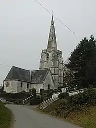 The church of Ligny-Saint-Flochel | |
 Coat of arms | |
Location of Ligny-Saint-Flochel | |
 Ligny-Saint-Flochel  Ligny-Saint-Flochel | |
| Coordinates: 50°21′32″N 2°25′47″E / 50.3589°N 2.4297°E | |
| Country | France |
| Region | Hauts-de-France |
| Department | Pas-de-Calais |
| Arrondissement | Arras |
| Canton | Saint-Pol-sur-Ternoise |
| Intercommunality | Ternois |
| Government | |
| • Mayor (2020–2026) | Jean-Marie Cretel[1] |
| Area 1 | 5.23 km2 (2.02 sq mi) |
| Population | 241 |
| • Density | 46/km2 (120/sq mi) |
| Time zone | UTC+01:00 (CET) |
| • Summer (DST) | UTC+02:00 (CEST) |
| INSEE/Postal code | 62514 /62127 |
| Elevation | 111–157 m (364–515 ft) (avg. 134 m or 440 ft) |
| 1 French Land Register data, which excludes lakes, ponds, glaciers > 1 km2 (0.386 sq mi or 247 acres) and river estuaries. | |
Ligny-Saint-Flochel (French pronunciation: [liɲi sɛ̃ flɔʃɛl]) is a commune in the Pas-de-Calais department in the Hauts-de-France region of France.[3]
Geography
Ligny-Saint-Flochel is situated 15 miles (24 km) west of Arras, at the junction of the D81 and the D83 roads.
Population
| Year | Pop. | ±% p.a. |
|---|---|---|
| 1968 | 227 | — |
| 1975 | 209 | −1.17% |
| 1982 | 236 | +1.75% |
| 1990 | 243 | +0.37% |
| 1999 | 202 | −2.03% |
| 2007 | 232 | +1.75% |
| 2012 | 260 | +2.31% |
| 2017 | 258 | −0.15% |
| Source: INSEE[4] | ||
Places of interest
- The church of St. Flochel, dating from the sixteenth century.
- The Commonwealth War Graves Commission cemetery.
See also
References
- ↑ "Répertoire national des élus: les maires". data.gouv.fr, Plateforme ouverte des données publiques françaises (in French). 2 December 2020.
- ↑ "Populations légales 2021". The National Institute of Statistics and Economic Studies. 28 December 2023.
- ↑ INSEE commune file
- ↑ Population en historique depuis 1968, INSEE
External links
Wikimedia Commons has media related to Ligny-Saint-Flochel.
This article is issued from Wikipedia. The text is licensed under Creative Commons - Attribution - Sharealike. Additional terms may apply for the media files.