Widehem | |
|---|---|
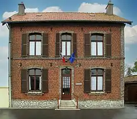 The town hall of Widehem | |
Location of Widehem | |
 Widehem  Widehem | |
| Coordinates: 50°35′11″N 1°40′23″E / 50.5864°N 1.6731°E | |
| Country | France |
| Region | Hauts-de-France |
| Department | Pas-de-Calais |
| Arrondissement | Montreuil |
| Canton | Étaples |
| Intercommunality | Deux Baies en Montreuillois |
| Government | |
| • Mayor (2020–2026) | Pierre Lequien[1] |
| Area 1 | 7.2 km2 (2.8 sq mi) |
| Population | 247 |
| • Density | 34/km2 (89/sq mi) |
| Time zone | UTC+01:00 (CET) |
| • Summer (DST) | UTC+02:00 (CEST) |
| INSEE/Postal code | 62887 /62630 |
| Elevation | 64–178 m (210–584 ft) (avg. 99 m or 325 ft) |
| 1 French Land Register data, which excludes lakes, ponds, glaciers > 1 km2 (0.386 sq mi or 247 acres) and river estuaries. | |
Widehem is a commune in the Pas-de-Calais department in the Hauts-de-France region of France.[3]
Geography
Widehem is located 19 km (12 mi) north of Montreuil-sur-Mer, on the D148E5 road, 5 km (3 mi) from the coast.
History
Known and recorded as "Wodingahem" in 877, after a Germanic chief of the region who opposed Charlemagne.
Population
| Year | Pop. | ±% p.a. |
|---|---|---|
| 1968 | 232 | — |
| 1975 | 195 | −2.45% |
| 1982 | 175 | −1.53% |
| 1990 | 229 | +3.42% |
| 1999 | 249 | +0.93% |
| 2007 | 259 | +0.49% |
| 2012 | 261 | +0.15% |
| 2017 | 244 | −1.34% |
| Source: INSEE[4] | ||
Places of interest
The neogothic church of St.Wulmer, dates from the sixteenth century.
Widehem is the site of a pioneering 6-turbine wind farm, that opened in 1999.
See also
References
- ↑ "Répertoire national des élus: les maires". data.gouv.fr, Plateforme ouverte des données publiques françaises (in French). 2 December 2020.
- ↑ "Populations légales 2021". The National Institute of Statistics and Economic Studies. 28 December 2023.
- ↑ INSEE commune file
- ↑ Population en historique depuis 1968, INSEE
Wikimedia Commons has media related to Widehem.
This article is issued from Wikipedia. The text is licensed under Creative Commons - Attribution - Sharealike. Additional terms may apply for the media files.