Hermies | |
|---|---|
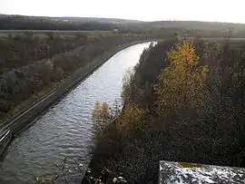 The Canal du Nord | |
Location of Hermies | |
 Hermies  Hermies | |
| Coordinates: 50°06′45″N 3°02′19″E / 50.1125°N 3.0386°E | |
| Country | France |
| Region | Hauts-de-France |
| Department | Pas-de-Calais |
| Arrondissement | Arras |
| Canton | Bapaume |
| Intercommunality | CC Sud-Artois |
| Government | |
| • Mayor (2020–2026) | Françoise Leturcq[1] |
| Area 1 | 13.05 km2 (5.04 sq mi) |
| Population | 1,117 |
| • Density | 86/km2 (220/sq mi) |
| Time zone | UTC+01:00 (CET) |
| • Summer (DST) | UTC+02:00 (CEST) |
| INSEE/Postal code | 62440 /62147 |
| Elevation | 77–127 m (253–417 ft) (avg. 121 m or 397 ft) |
| 1 French Land Register data, which excludes lakes, ponds, glaciers > 1 km2 (0.386 sq mi or 247 acres) and river estuaries. | |
Hermies (French pronunciation: [ɛʁmi]) is a commune in the Pas-de-Calais department in the Hauts-de-France region of France.[3]
Geography
Hermies is a farming village situated 10 miles (16 km) southeast of Arras, at the junction of the D5 and the D19 roads.
Population
| Year | Pop. | ±% p.a. |
|---|---|---|
| 1968 | 1,287 | — |
| 1975 | 1,263 | −0.27% |
| 1982 | 1,189 | −0.86% |
| 1990 | 1,138 | −0.55% |
| 1999 | 1,130 | −0.08% |
| 2007 | 1,156 | +0.28% |
| 2012 | 1,179 | +0.39% |
| 2017 | 1,180 | +0.02% |
| Source: INSEE[4] | ||
Places of interest
- The church of Notre-Dame, rebuilt after World War I.
See also
References
- ↑ "Répertoire national des élus: les maires". data.gouv.fr, Plateforme ouverte des données publiques françaises (in French). 2 December 2020.
- ↑ "Populations légales 2021". The National Institute of Statistics and Economic Studies. 28 December 2023.
- ↑ INSEE commune file
- ↑ Population en historique depuis 1968, INSEE
External links
Wikimedia Commons has media related to Hermies.
- Personal website about Hermies (in French)
This article is issued from Wikipedia. The text is licensed under Creative Commons - Attribution - Sharealike. Additional terms may apply for the media files.