Baralle | |
|---|---|
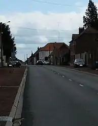 The main road of Baralle | |
 Coat of arms | |
Location of Baralle | |
 Baralle  Baralle | |
| Coordinates: 50°12′45″N 3°03′32″E / 50.2125°N 3.0589°E | |
| Country | France |
| Region | Hauts-de-France |
| Department | Pas-de-Calais |
| Arrondissement | Arras |
| Canton | Bapaume |
| Intercommunality | CC Osartis Marquion |
| Government | |
| • Mayor (2020–2026) | Jean-Pierre Lestocard[1] |
| Area 1 | 7.95 km2 (3.07 sq mi) |
| Population | 449 |
| • Density | 56/km2 (150/sq mi) |
| Time zone | UTC+01:00 (CET) |
| • Summer (DST) | UTC+02:00 (CEST) |
| INSEE/Postal code | 62081 /62860 |
| Elevation | 44–78 m (144–256 ft) (avg. 69 m or 226 ft) |
| 1 French Land Register data, which excludes lakes, ponds, glaciers > 1 km2 (0.386 sq mi or 247 acres) and river estuaries. | |
Baralle (French pronunciation: [baʁal]) is a commune in the Pas-de-Calais department in the Hauts-de-France region in northern France.[3]
Geography
A farming village located 15 miles (24 km) southeast of Arras at the junction of the D14, D16 and D19 roads. The entire commune was obliterated during World War I.
Population
| Year | Pop. | ±% |
|---|---|---|
| 1962 | 482 | — |
| 1968 | 491 | +1.9% |
| 1975 | 442 | −10.0% |
| 1982 | 418 | −5.4% |
| 1990 | 468 | +12.0% |
| 1999 | 487 | +4.1% |
| 2006 | 493 | +1.2% |
| 2009 | 485 | −1.6% |
| 2011 | 478 | −1.4% |
| 2015 | 478 | +0.0% |
Sights
- The ruins of an early castle.
- The church of St. Georges, dating from the twentieth century.
See also
References
- ↑ "Répertoire national des élus: les maires". data.gouv.fr, Plateforme ouverte des données publiques françaises (in French). 2 December 2020.
- ↑ "Populations légales 2021". The National Institute of Statistics and Economic Studies. 28 December 2023.
- ↑ INSEE commune file
Wikimedia Commons has media related to Baralle.
This article is issued from Wikipedia. The text is licensed under Creative Commons - Attribution - Sharealike. Additional terms may apply for the media files.